MINERAL PROSPECTS FOR PROMOTING GREENFIELD AREAS
Mineral Resources: Gold - Copper - Iron - Base Metals - Rare Earth Elements Minerals
IDENTIFYING THE AREA
The area being promoted has mining potential for the prospecting of Base Metals, an essential raw material for use in various sectors of the manufacturing industry. It is a greenfield area, the groundwork for which took place during the implementation of the National Geology Plan (PLANAGEO).
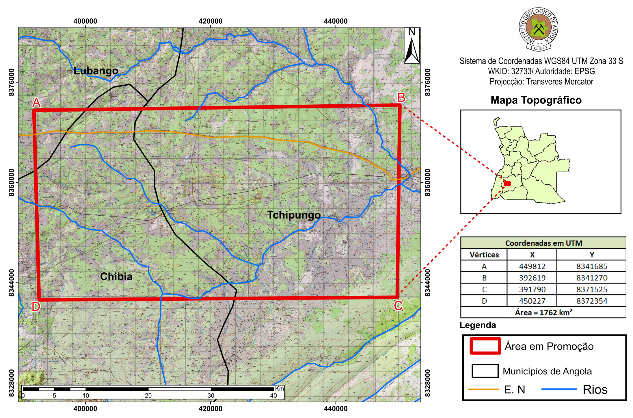
Area (Km2)
1762
Municipalities
Lubango e Quipungo
Provinces
Huíla
Mineral Resources
Basic Metals
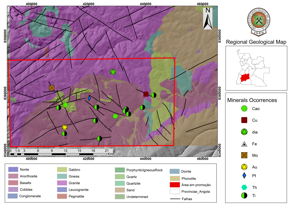
REGIONAL GEOLOGY
The area is located on Sheet SUL D-33O, at a scale of 1:250,000, where the Cunene Anorthosite Complex and the Quipungo-Chitempo metamorphic plutonic complex outcrop, containing anorthosite, gabbro, norite and troctolite rocks, metagabbro and metadiorite rocks, variably migmatized orthogneisses and paragneisses, ocellar porphyroids, biotite granites and granodiorites, porphyroids, foliated granites and porphyroid granites.
There are no pleniplanic deposits or sediments, but there are fluvial and runoff deposits containing sands, clays and gravels, eluvio-alluvial deposits with pebbles, sands and clays, gravitational deposits with white and greyish washed sands, and also yellow-ochre sands, sometimes reddish, which are part of the Upper Kalahari Subgroup, as well as gabbros, microgabbros and dolerites, basalts and dolerites, which occur in the Basaltic Suite Associated with the Cunene Anorthositic Complex.
In and around the area, there are potential occurrences of rocks containing gold, copper, iron-titanium,molybdenum, platinum and titanium.
RECENT WORK AND RESULTS
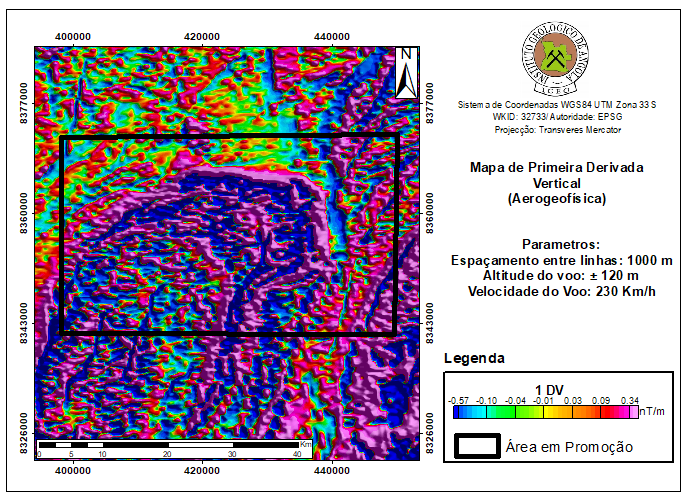
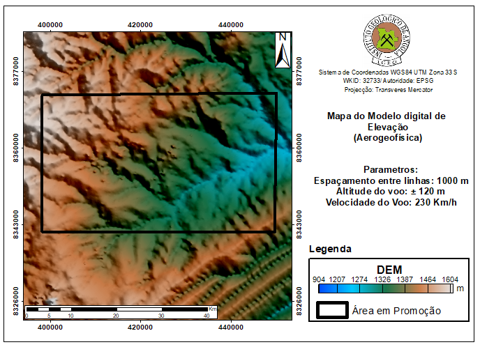
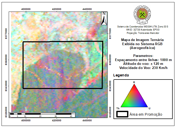
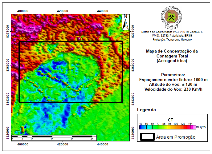
The area under promotion has aero-geophysical information on magnetometry and radiometry acquired by means of flight lines with a spacing of 1,000 m and an altitude between 80 to 120 m. This data, available from the Geological Institute of Angola, can be used as support during the development of geological-mining activities.
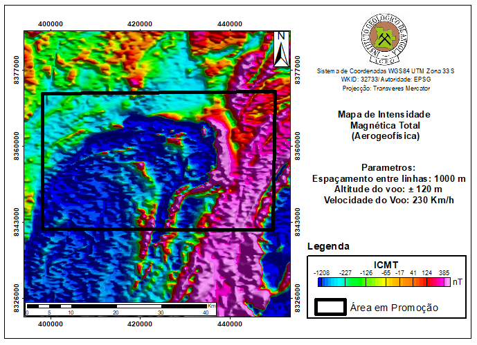
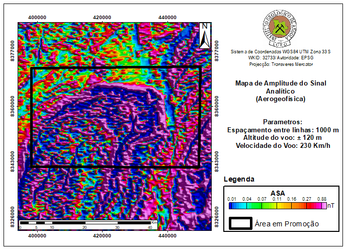
The following results were obtained:
- Airborne geophysics (magnetometry and radiometry);
- Systematic geological mapping at a scale of 1:250,000;
- Regional geochemistry at a scale of 1:250,000;
- Various specific studies relating to areas of special geological interest.
The following maps were produced from the airborne magnetometry and gamma spectro- metry campaign:
- Map of total magnetic field strength corrected for IGRF and reduced to the pole;
- Map of derivatives (1st and 2nd vertical derivatives of magnetic field strength);
- Horizontal gradient in Y of the magnetic field intensity reduced to the pole. The same was done for remote sensing. Terrain elevation model (DEM);
- Ternary radiometric map (K, U, Th);
- Total count radiometric map.
INFRASTRUCTURE AND SERVICES
The region is endowed with essential infrastructure and services for the development of mining projects, such as:
- The area can be accessed via National Road 280, which connects the city of Lubango to the municipalities of Bibala and Namibe, as well as via Lubango City airport;
- The Port of Namibe, the Moçâmedes Railway and the Bibala Logistics Base can be used during all stages of geological and mining activities;
- The existence of laboratory services to support geological-mining activities, belonging to the Geological Institute of Angola, in Huíla Province;
- Electricity can be supplied from the connection to the National Electricity Transmission Network; Existence of financial services and solid telecommunications structures.