MINERAL PROSPECTS FOR PROMOTING GREENFIELD AREAS
Mineral Resources: Gold - Copper - Iron - Base Metals - Rare Earth Elements Minerals
IDENTIFYING THE AREA
The area being promoted has mining potential for the prospecting of Basic Metals, an essential raw material for use in various sectors of the manufacturing industry. It is a greenfield area, the groundwork for which took place during the implementation of the National Geology Plan (PLANAGEO).
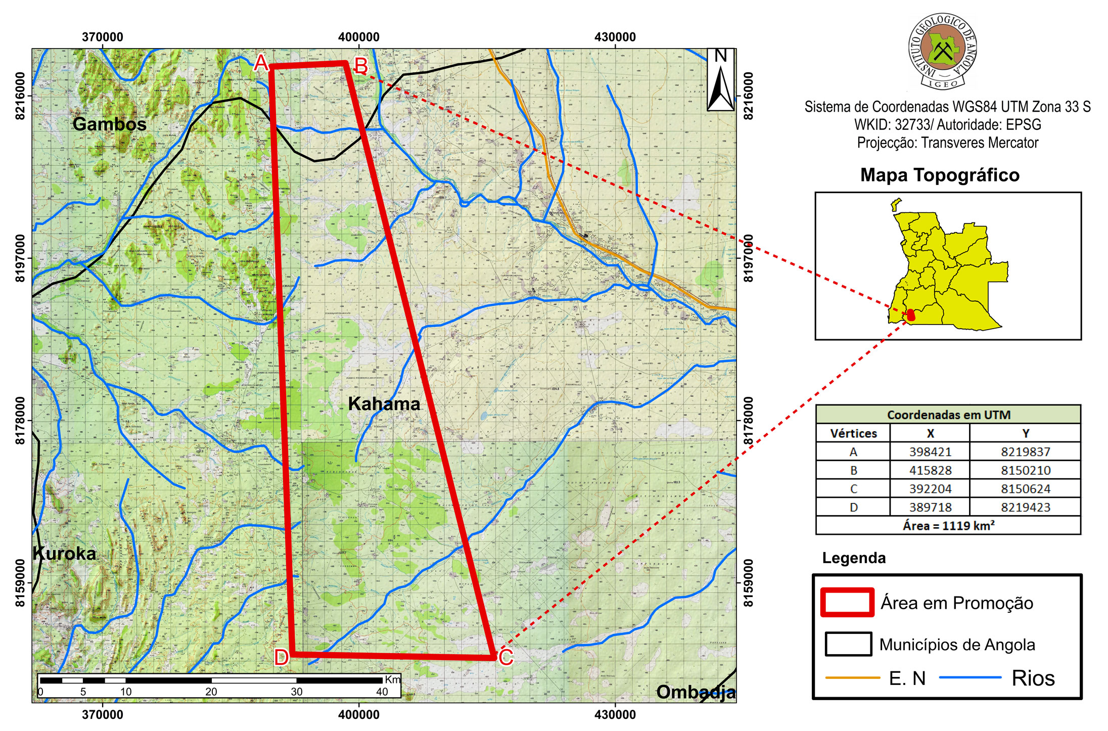
Area (Km2)
1119
Municipalities
Chama e Gambos
Provinces
Cunene e Huíla
Mineral Resources
Basic Metals
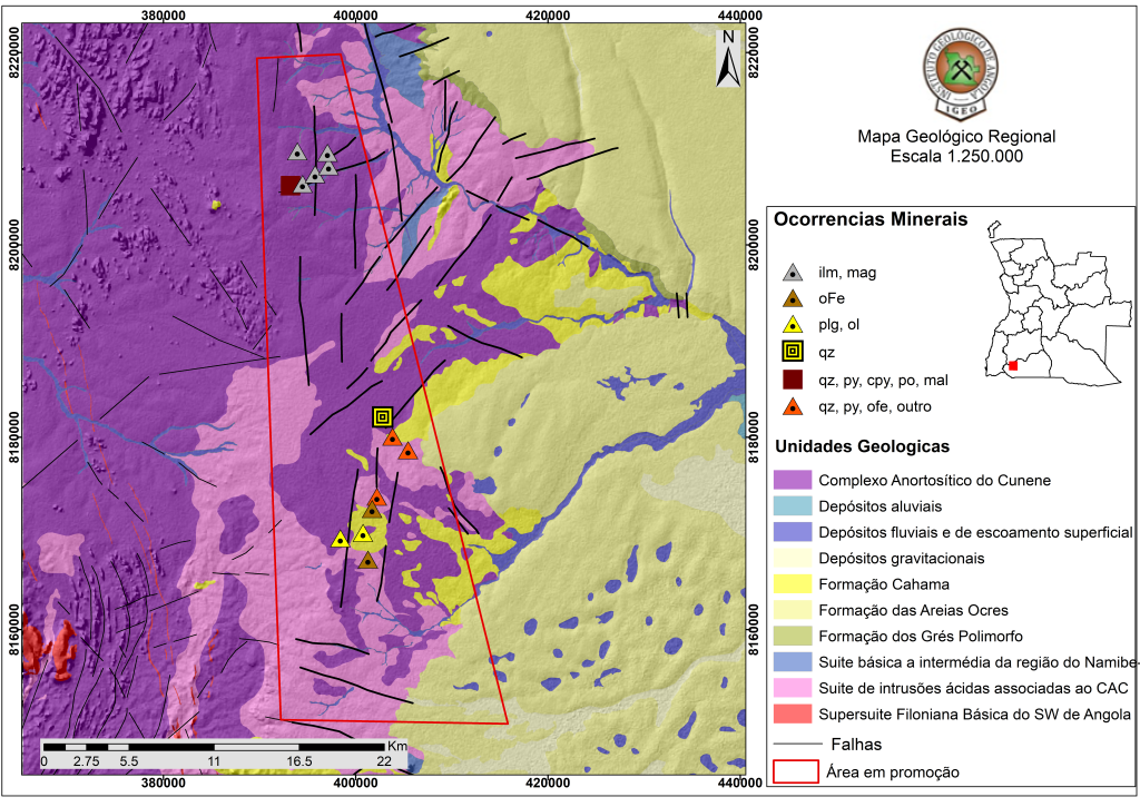
REGIONAL GEOLOGY
This area is on the SUL D33C sheet, at a scale of 1:250,000, where the Cunene Anorthosite Complex outcrops, containing anorthosites, gabbros and micro-gabros, titano-magnetite, leucotroctolites, leucogabronorites, leucogabros and leuconorites, sometimes deformed and metasomatized anorthosites.
The Fe and Ti mineral occurrences are quite numerous and are associated with the erosion of the Cunene Anorthositic Complex, corresponding to alluvial-eluvial deposits marked by the presence of ilmenite, titano-magnetite and sometimes magnetite. They correspond to alluvial-alluvial deposits marked by the presence of ilmenite, titano-magnetite and sometimes magnetite forming blocks or shells.
In and around the area, there are potential occurrences of rocks containing Copper, Iron, Titanium and Ornamental Rocks.
RECENT WORK AND RESULTS
The area under promotion has aero-geophysical information on magnetometry and radiometry acquired by means of flight lines with a spacing of 1,000 m and an altitude between 80 to 120 m.
This data, available from the Geological Institute of Angola, can be used as support during the development of geological-mining activities.
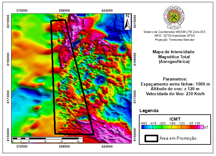
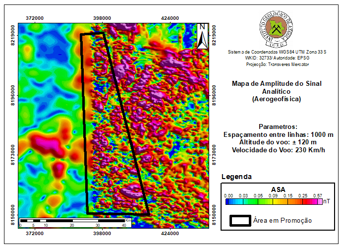
The following results were obtained:
- Airborne geophysics (magnetometry and radiometry);
- Systematic geological mapping at a scale of 1:250,000;
- Regional geochemistry at a scale of 1:250,000;
- Various specific studies relating to areas of special geological interest.
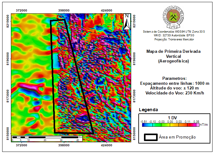
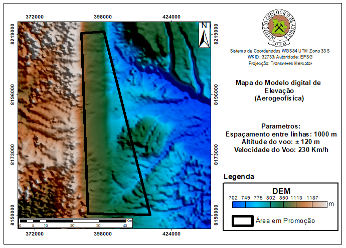
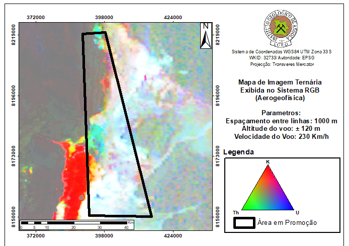
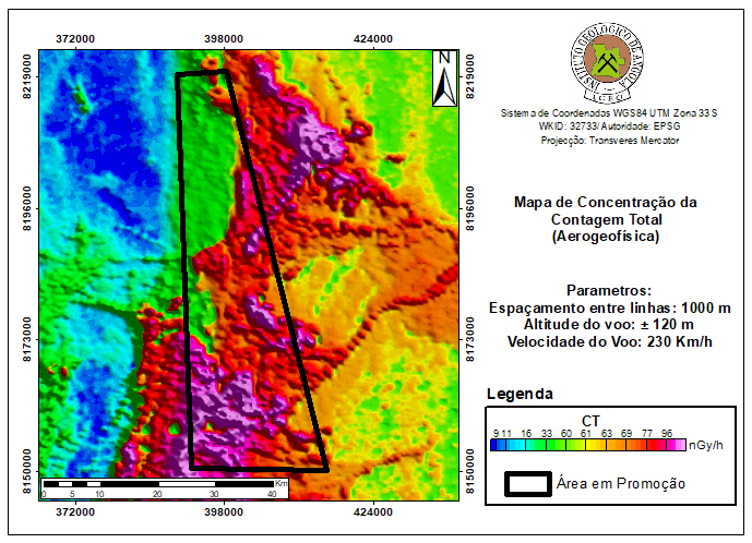
The following maps were produced from the airborne magnetometry and gamma spectro- metry campaign:
- Map of total magnetic field strength corrected for IGRF and reduced to the pole;
- Map of derivatives (1st and 2nd vertical derivatives of magnetic field strength);
- Horizontal gradient in Y of the magnetic field intensity reduced to the pole. The same was done for remote sensing. Terrain elevation model (DEM);
- Ternary radiometric map (K, U, Th);
- Total count radiometric map.
INFRASTRUCTURE AND SERVICES
The region is endowed with essential infrastructure and services for the development of mining projects, such as:
- The area can be accessed via National Road 105, which connects the city of Lubango and Ondjiva;
- The Port of Namibe and the Cahama Logistics Base can be used during all stages of geological -mining activities;
- The existence of laboratory services to support geological-mining activities, belonging to the Geological Institute of Angola, in Huíla Province;
- Electricity can be supplied from the connection to the National Electricity Transmission Network;
- Existence of financial services and solid telecommunications structures.